For the residents of Londonderry and Castlereagh, February 9 will always be remembered as a dark day.
It was the day they experienced a flood emergency that grabbed national headlines. Three consecutive storm cells saw over 115mm of rain fall in the region, swelling local creeks and drains and flooding over a dozen homes in Londonderry and Castlereagh.
State Emergency Services received some 288 calls for assistance and 19 people were rescued from the floods.
Now, eight months later, a report into the Torkington Creek, Londonderry flood has revealed that the local drainage system was considerably constrained due to a lack of maintenance, which may have contributed to flood levels that inundated several homes.
According to an investigation carried out by environment and natural hazards consultants, Molino Stewart, drainage throughout the catchment was generally constricted by vegetation, debris and silt build up, sometimes at levels between 30 and 50 per cent.
“The blockages in these culverts and channels may significantly reduce the conveyance of the channel and increase the flood levels… whilst the culvert capacity was not exceeded, the downstream vegetation may have increased flood levels upstream,” the report said.
“The constructed drainage system has been designed to drain waters after a rain event has occurred, not to carry all flows. Analysis of the major culverts in the catchment suggests that most, with the exception of the major structure on Londonderry Road, will not pass a 1 in 20 year event.”
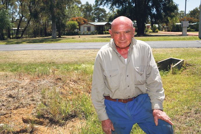
Raymond Zara has been a resident on Hinxman Road for 31 years and said that during his time in the area he has seen how drainage changes made by Penrith City Council have only made flooding in the area worse.
Mr Zara’s property is located on a plateau only a couple of hundred metres from the Penrith Lakes Scheme, yet trenches dug by Council drain the water all the way to Torkington Creek.
“I am told that my property is the lowest point on this road. In 2001 Council dug an easement alongside my property, which now channels more water to the property and down Torkington Creek than before,” he said.
“I have suggested to Council that they should be draining the water to the Penrith Lakes Scheme, which is much closer, but they have not listened. The easement flows in that direction [towards Torkington Creek] meaning that more water reaches Londonderry even faster.”
Fellow Hinxman Road resident, Martin Van Dongen, said that when his family moved into their property in October 2010, they approached Penrith City Council on a number of occasions to have a neighbouring easement cleared.
“The previous owners had the easement cleared twice a year by Council. We approached them half a dozen times before the February floods but it was never done,” he claimed.
“We have two houses on our property – one at ground level at the front and one about thigh high further back. On February 9 we had to get my daughter Kelly and her four kids from the front house and wade through waist deep water to our house – and the kids were very scared.”
In the days that followed, Mr Van Dongen said that he was disappointed with Penrith City Council’s response.
“The next morning we were at Council’s doorstep asking for help to clean up. A week later they sent around a letter saying that any residents requiring extra waste services could request them,” he said.
“We filled two skip bins with other people’s rubbish and debris at our own cost – you can’t have rotten vegetation and nappies lying around for two weeks.”
The report also raises serious concerns about the state of the local roads that would be used as evacuation routes.
Hinxman Road is a regional evacuation route for a Hawkesbury Nepean flood.
“Hinxman Road was inundated for a reasonably significant period of time with an estimated depth between 150mm and 400mm… [this] is cause for considerable concern,” the report said.
According to the report, the road is constructed with a reasonably thin base, which after being inundated would then be subjected to thousands of vehicle movements in the space of approximately seven hours, including many heavy vehicles, as evacuations take place.
“This raises questions of how long will the road surface last under these conditions before it becomes impassable and the evacuation is halted,” the report said.
The report has also identified bund walls along Torkington Road, Londonderry as a contributing factor to the flood levels, as well as constricted flow through the Londonderry Road culvert (for reasons unidentified), which led to flooding at Warrina Place, also in Londonderry.
On Wednesday, a Council spokesperson told the Weekender that a public meeting would be held in November, with letters to be sent to residents shortly.
“Council takes our responsibility for drainage very seriously and maintains well an extensive drainage network across the City within our available resources,” the spokesperson said.
“We are pleased to have the independent report and look forward to the community’s feedback on the report’s findings.”
The full report is available on Council’s website, and a summary will be sent to residents.

